|
Courtesy of:  |
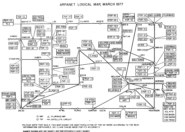 |
| The map above shows the topology of ARPANET in March 1977.
It was scanned
by Larry Press from the ARPANET Completion Report , Bolt, Beranek and Newman, Burlington, MA, January 4, 1978. |
 |
|
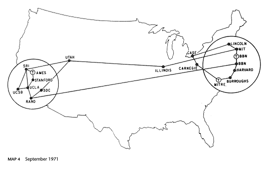
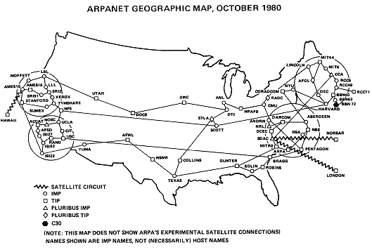
September 1971and the one below is from October 1980, which includes a packet satellite link UCL in London. (Sources : "Casting the Net", page 64; CCR, page 93) |
 |
| Back to Report |